These are based on the NCEP Reanalysis GCM with the only forcing being the observed monthly sea surface temperatures.
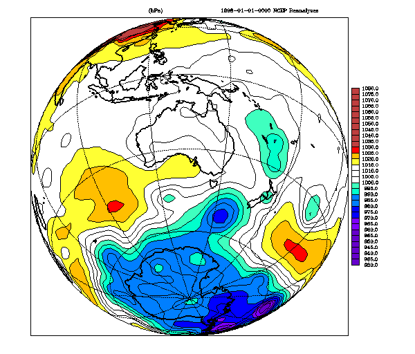
Jan 1-7 1998 Mean sea level pressure - viewpoint 40 deg. S 135 deg. E
Provided by Kevin Keay
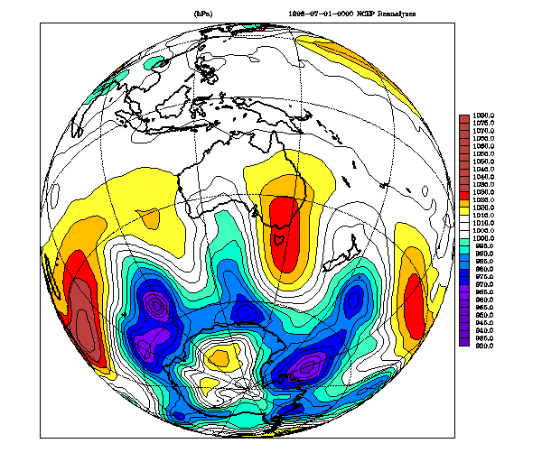
Jul 1-7 1998 Mean sea level pressure - viewpoint 40 deg. S 135 deg. E
Provided by Kevin Keay
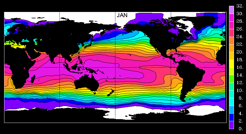
Climatology of sea surface temperature
Provided by Ross Murray
Antarctic 1998 daily sea ice concentration
Provided by Andrew Watkins
Special colours are pale purple ('weather'), darker purple (no data), gray (too much land near the cell for reliable ice concentrations), and black (land). Red indicates low concentrations (16 to 28 percent), while blue indicates high ice concentrations (over 85%).
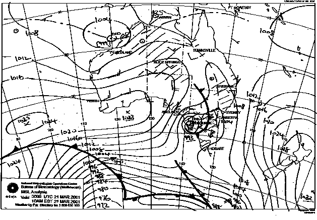
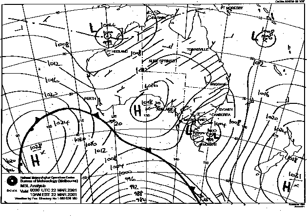
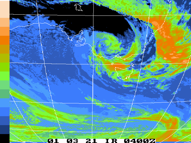
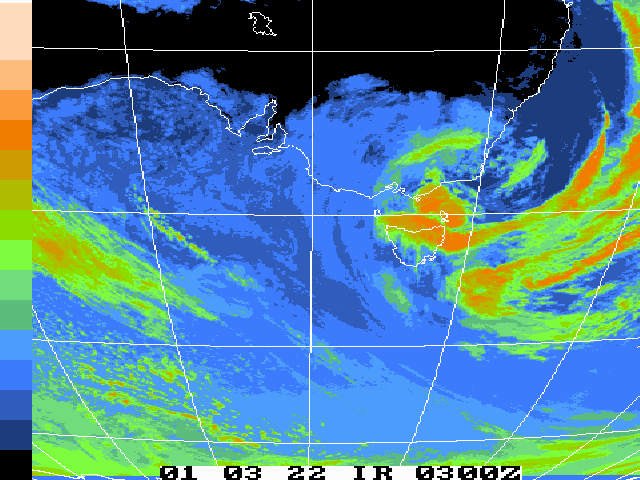
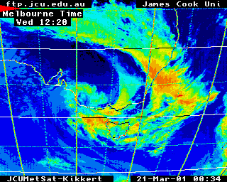
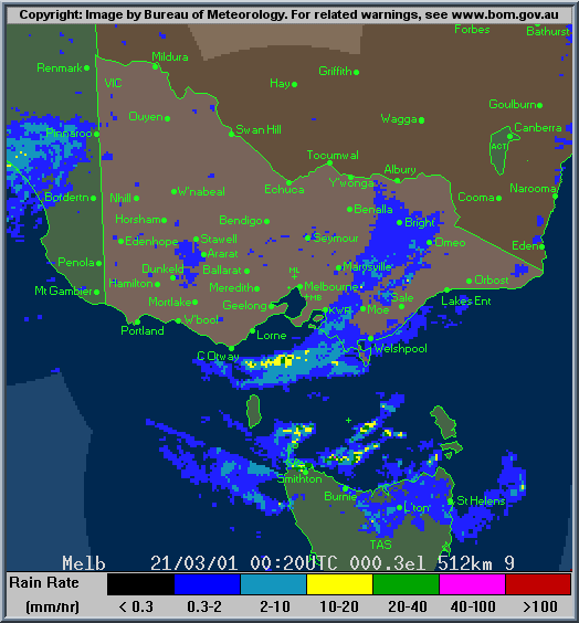
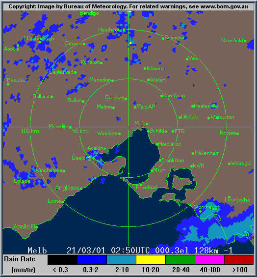
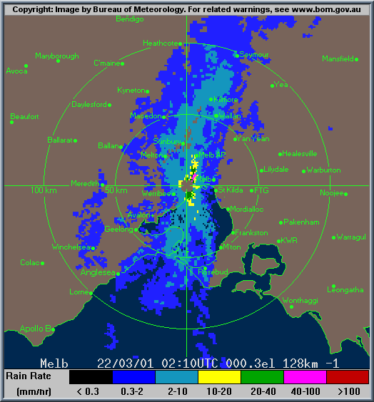
Unusual Rainfall Event over Melbourne March 21-22 2001
Provided by Kevin Keay
The charts and observations referred to in this discussion are
Copyright
Commonwealth of Australia 2001, Bureau of Meteorology
except (*) The Department of Electrical and Computer Engineering at
James Cook University,
Townsville, Australia which receives and
processes the raw images provided by
the Japanese Meteorological Agency.
On March 21-22 2001 (Wed-Thu) an unusual rainfall event occurred over Melbourne. A low pressure system moved eastward over southern Victoria.
The associated cold front produced some rain early on Wed morning but the day was relatively fine until the mid afternoon (3 pm AEDT) when thunderstorms developed over the city and inner suburbs; this air came from the north. There were modest amounts of rain in Melbourne on Wed night.
On Thu morning the trailing arm of cloud at the rear (west side) of the low moved slowly over Melbourne with heavy rain restricted to a narrow
S-N oriented band over the inner city out to the northern and western suburbs. The highest totals occurred at Melbourne Airport to the north (99 mm) and Laverton to the west (92 mm) with 44 mm in the city gauge in the 24 hours to 9 am EST Fri March 23 2001. In the case of Melbourne Airport the total to 3 pm of 98.8 mm on March 22 was higher than the
previous highest 24 hour total for March since records commenced there in 1970.
At Laverton 91.2 mm fell in the same period and this also exceeded the previous
24 hour highest for March. In the Melbourne CBD the 6 hour figure of 41.8 mm to 3
pm was higher than any 24 hour fall in March since 1970.